Download
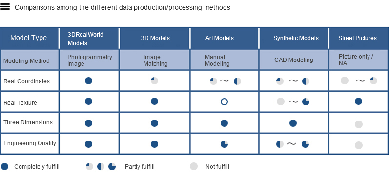
Panoramic Photorealistic 3D Data is an image containing and representing terrain, objects, and surface texture of the ground it covers. It totally and truthfully renders real world in shape and look, and in 3 dimensions in computer. A real world 3D image is made of high resolution terrain and imagery data, and is produced by our proprietary processing procedures and processes for mapping of 1:1000 scale.
Simply speaking, Panoramic Photorealistic 3D Data presents the real world on a computer, but not to rebuilt the world as the CAD 3D building models do.
Panoramic Photorealistic 3D Data is a modeling by photogrammetry method*, which are real, direct, visible, and accurate. They provide not only a real overall vision, but also accurate position and measurement, which support the management and decision making in many fields, and the public communication media. They are the trend of future geospatial data development.
*Modeling methods are classified into image matching, CAD modeling and photogrammetry modeling. Photogrammetry modeling is the most realistic modeling method.
|
|